Putorana, Putoramo, Pateromi, Kutaramo and even Payturama – the number of names of the least explored mountain range in Russia could almost outnumber the number of local residents. This grand lost world seems to have collected all the incredible records. Here is the geographical center of Russia and the Russian pole of inaccessibility – the most remote from transport routes and inaccessible point of our country. Winter here lasts eight months a year, the temperature is like outside a plane (minus 55 degrees), and there is no frost-free period at all. And during a very short but lush summer, thousands of waterfalls thaw, among which is Talnikovy – the highest in Eurasia.
The cluster of mesas, that is, mountains without peaks, was formed due to the eruption of an ancient supervolcano that happened 250 million years ago, even before the first dinosaurs crawled onto land. The hardened magma formed the so-called traps – stepped mountains, entirely composed of basalt. Later, as a result of seismic activity, the heart of the Siberian trap province rose one and a half kilometers and broke like a crust of fresh bread into hundreds of canyons and thousands of lakes. By the way, geologists believe that the plateau is still growing at a rate of 11 millimeters per year.
The project "Travels with the RGS" offers to go on a real expedition to the country of lava mountains, the area of which is larger than the UK, and most of it remains inaccessible: you can get there by boats or snowmobiles, and to some parts, only by helicopter. But nevertheless, these places are increasingly chosen by tourists every year. Here are five reasons for this.
The land of a thousand waterfalls
The honor of discovering and creating the first scientific description of the Putorana belongs to the active figure of the Imperial Russian Geographical Society Alexander von Middendorf, who, in 1845, during an expedition to the Taimyr discovered the spurs of the plateau and marked the boundaries of the permafrost. The toponym "Putorana" was put on the map in 1921 by the Soviet Arctic explorer Nikolay Urvantsev, who had heard this term from a local Evenk. Interestingly, there is still no unambiguous translation of the name. The Evenk people more often called this place "Petere", which means "smoking, covered with clouds"; and "Kuturamo" – "swampy". Their Yukaghir neighbors used a more precise definition – "Puren anaa", which means "mountains without peaks". However, everyone agreed on a single belief in the greatness and primordial power of this place: for a long time only shamans could live in these lands.
Today, these territories belong to the Putoransky Nature Reserve, which is a part of the Joint Directorate of the Taimyr Nature Reserves – to visit the plateau, you need to acquire a permit using the phone numbers listed on the website.
Turbulent rivers, cascading from wide ledges, flow through countless canyons that cut through the mountains in bizarre patterns. Another record of the mysterious Putorana is the largest concentration of waterfalls in Russia. Majestic streams of water live their own lives, thawing from glaciers and snowfields, then accumulating due to past precipitation, then again freezing in immobility. In winter, the waterfalls turn into icefalls, covering the space around with giant snow terraces – a spectacle no less fantastic.
Such, for example, is the tallest in Russia Talnikovy Waterfall, which is "awake" for only one and a half to two months a year. 15 steps of its cascade bring down the water column from a height of almost half a kilometer. The inaccessibility and rather short season, complicated by dry periods when the water level drops significantly, seriously complicate the work of geographers who still do not agree on the exact height of the waterfall. According to various estimates, it ranges from 480 to 700 meters. For the same seasonal reasons, some scientists do not consider the Talnikovy Waterfall a waterfall at all, calling it a temporary watercourse active during the high water season.
The second (and in some cases, the first) highest waterfall in Russia is called the Kandinsky Waterfall – the height of the direct fall of the Kanda River is 108 meters. From the observation deck, there are views of the rapid cascades and the Khibarba River flowing in the lowlands, divided into hundreds of branches.
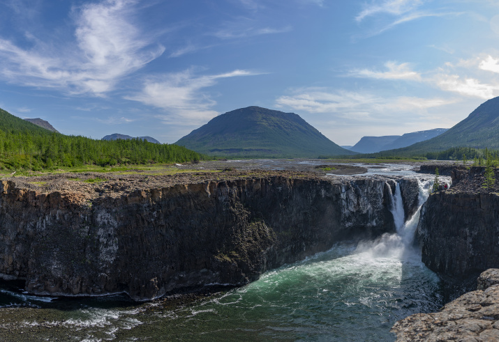
One of the most picturesque and famous on the plateau is the Bolshoy Irkindinsky Waterfall, or, as it is called by the Nganasans – the indigenous inhabitants of the Taimyr – the Kitobo-Oron. Its height is not so impressive, only about 30 meters, but the power of the crashing Irkinda River in this place is so great that it seems as if the earth is shaking under your feet. Ledges of hexagonal basalt columns, or, as geologists say, columnar jointings, add a cosmic flair to the landscape and resemble the famous panoramas of Iceland and Iturup.
Putoran fjords
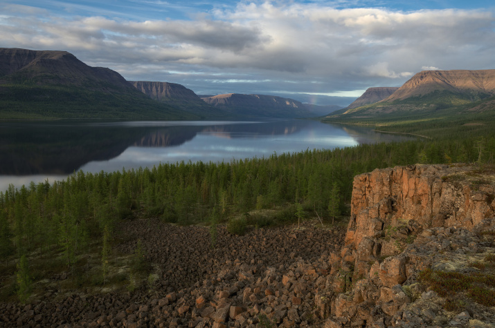
Only lakes can compete with the number of waterfalls on the plateau – there are more than 25 thousand of them here, together they occupy a tenth of the area of the reserve and, following Baikal, are one of the largest freshwater reserves in the country. The long, winding and incredibly deep Putoran lakes were born in the basalt crevices, which makes them look like fjords, only without sea water.
The largest and most beautiful lakes can be found in the western part of the plateau. The slopes of the mountains here are mostly steep, unlike in the gentler southeastern sector, so the contrast between the stepped spurs and the dark blue water is much higher. Popular with travelers Lake Lama, 120 kilometers from Norilsk, is one of the deepest in Russia. Its name is consonant with the Evenk "lamu", which means "sea". Like many around, the lake sleeps under a meter-thick layer of ice for eight winter months, finally waking up only in the middle of summer along with other rivers flowing into the reservoir in wide cascades.
Lama can be called a kind of gateway to the kingdom of Putorana: the main waterway to the plateau runs through here. In a couple of hours by boat on the Norilsk River, which flows into the lake, you can get to the northwestern tip of the mountains. On the shore there is a campsite with wooden houses, a sauna, a hot furako bath and interiors styled after the life of the northern peoples. A little farther away, on the eastern edge of the lake, there is another recreation center. It is convenient to settle there and make small trips from there – there are no other permanent hotels in the reserve.
By the way, another incredible record: due to the difference in climate zones, the temperature difference during the year in various parts of the plateau can reach 100 degrees. Therefore, your hiking wardrobe should be thought out very carefully when planning the trip.
Where no human has ever set foot
There are practically no well-trodden paths on the Putorana – the reserve's employees tirelessly monitor this. However, under the guidance of an experienced gamekeeper, you can climb several hiking routes that do not require special equipment. One of the popular routes goes from Lake Lama along the slopes of Festivalnaya Mountain. The nice thing about the route is that it is suitable for people in any physical shape (the height is only 750 meters), and the view from the top will certainly cause a full range of emotions. A dense carpet of cranberries and yagel underfoot, picturesque buttes among low northern trees and a panorama of the two lakes – Lama and Kapchuk – separated by a narrow isthmus.
Another easy route leads along the shore of Lake Lama to Neralakh Canyon. Here, a waterfall of several picturesque rapids falls from 20-meter cliffs. Trekking routes to the plateau itself are quite difficult and require good physical training and proper equipment. With the climb, the fragrant taiga with scatterings of mosses gradually gives way to a treeless stone run – clusters of boulders. Here you can meet the endemic of the Northern Yenisei – the Putorana snow sheep, listed in the Red Book. Separated from their relatives by tens of thousands of kilometers, these incredibly powerful but agile animals adapted to the harsh conditions of these places and formed their own separate species. With high speed, they can move along mountain ledges and almost vertical slopes of the plateau.
For those who would not dare to conquer the harsh mountains, there is an equally exciting alternative – a helicopter drop-off. Truly cosmic landscapes open up from the air. From a bird's-eye view, you can see the stretching strings of giant crevices filled with water, and appreciate the size of the plateau itself.
Pole of inaccessibility
A desirable point on the map for those who like to collect geographical extremes is the pole of inaccessibility – this is the name of a continental or water location farthest from the coastline and transport routes. In Eurasia, this point is located in the foothills of northern China; Russia also has its own spot, on the shore of Lake Beldunchana, between the southern spurs of the Putorana Plateau. Translated from the Evenk "beldunchana" means "breaking": the shape of the narrow curved tectonic lake resembles a carrying pole from above. Despite the romantic name, the pole of inaccessibility is actually a really accessible point. There are several ways to get to the lake: by boat from the village of Svetlogorsk along the Kureyka River or by helicopter. Nevertheless, both options involve a lot of difficulties, so the place is still considered exotic among travelers.
Also here, a hundred kilometers to the southwest, not far from Lake Vivi, according to most calculations, is the geographical center of Russia. Interestingly, the point is located only 16 kilometers south of the Arctic Circle, and at coordinates north of Arkhangelsk and east of Krasnoyarsk.
Dmitry Mendeleev was the first to calculate the center of the Russian Empire back in 1906 – the point was charted somewhat to the west and much to the south, in Yamalo-Nenets Autonomous Okrug, not far from the bank of the Taz River. In the post-Soviet period, in 1992, the calculations were updated: the expedition of the Moscow Branch of the Russian Geographical Society under the leadership of Ivan Papanin installed a memorial sign in the new center of Russia – a stele in the form of a blooming flower with commemorative inscriptions. In 2006, a chapel in memory of Sergius of Radonezh was consecrated on the shore of the lake.
Mammoths and permafrost
In addition to the beautiful nature, there are several colorful objects telling about the history and cultural customs of the Far North on the Putorana, which are worth checking out when visiting the place. The largest city in the area (and the largest northern city on Earth), Norilsk, is certainly interesting in itself: this is the main gate to the plateau and the nearest to the reserve large city with an airport. A small one-story log house deserves special attention – the first house in the city. It was built by the same Nikolay Urvantsev, who immortalized the Putorana Plateau on the map during his geological exploration expedition. In it the researcher spent his first winter. In 2021, the building turned one hundred years old. Inside there is an exhibition telling about the participants of the expedition, as well as the history of the foundation of the city.
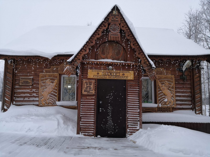
In Igarka, a couple of hundred kilometers to the south, on the bank of the Yenisei, there is a unique permafrost museum – the world's only exhibition in the underground permafrost at a depth of 10 meters. The walls of the halls there are chained with ice: to maintain the right temperatures in the "room", bright lights are not used, and people are brought in small groups. Among the exhibits are books and newspapers, samples of local flora, as well as a collection of ice samples that are up to 50 thousand years old. The museum was built at the permafrost laboratory, the research of which was used for the construction of oil and gas pipelines.
In Dudinka, the northernmost international seaport of Russia, there is the largest collection of the history of local minorities – the Taimyr Museum of Local History. Ethnographic collections display rare cult items of the Nganasans, Enets, Nenets, Dolgans, Evenks: idols, ritual masks, sets of shaman costumes and ceremonial clothing. During an exciting history tour, you can see what chums looked like from the inside, and find out how these people survived in the harsh conditions of the Far North, how their way of life, religious beliefs and values differed. A separate hall of the museum is dedicated to the era of explorers and the development of the Taimyr in the 16th–17th centuries.
In the northeast of the Putorana Plateau, in the small village of Khatanga on the banks of the Kotuy River, there is the Mammoth Museum. But unlike the Yakutsk one, where the largest remains collection of these ancient animals is located, the museum in Khatanga is located in a cave in the ice for greater epicness. The temperature of minus 15 degrees is maintained there all year round: the ice covers of the grottoes bind mammoth tusks, bones and teeth of animals collected in these places. The main exhibit of the museum is the first mammoth found nearby, which was named after the reindeer herder who discovered it – Zharkov's mammoth. According to scientists, its age is more than 20 thousand years.
"Travels with the RGS" is a collection of fascinating author's tours of Russia from Russian tour operators, which have been peer-reviewed by the Society’s specialists and received a distinguishing quality stamp "Recommended by the RGS".
The system of voluntary certification of routes, developed jointly with the Russian State University of Tourism and Service, means that the route meets all quality and safety requirements, and is also an authentic, unique and informative product.
Julia Gopius


